

Caterpillar March: Hiking the Larapinta Trail
It’s always those final few kilometres, that last mile, the painful, plodding steps towards an elusive end. They drag, they stretch, those drawn out, torturous, seemingly unending trails to nowhere. That final march, when each step is laboured, and your soles ache and your mind is exhausted. Those are the moments, and if they do not break you, they make you.
Angkale Junction is the final checkpoint on section 3 of the Larapinta Trail, beginning at Iwupataka (Jay Creek) and finishing at Angkerle Atwatye (Standley Chasm). After hours stumbling through dry river beds and scrambling over boulders, I collapse under a tree. My chest heaves, and beads of sweat pour down my back, my legs twitch. This must be the final ridge; it has to be. I cannot climb another one. Surely this is it. Perched uncomfortably, on dusty, pale yellow rocks, I stare at the ground, head in hands. A swarm of flies buzz around me, pestering, aggravating, and I barely have the energy to shoo them away. Fuck off flies. On the baked earth, the shadows of gum leaves are cast, and the sharpness of their edges reinforces the intensity of the remorseless sun. It has been stalking me all morning, gnawing at me, sapping my energy, and it has almost succeeded. How can I going to do another 9 days of this? Can I? How can I even make it to Standley Chasm? That final kilometre and a half, less than a mile, it might as well be ten.

Under the midday sun at Angkale Junction, day 3
The Larapinta Trail, one of Australia’s premier hiking routes, snakes more than 200kms through the scorched red centre of the continent. On the lands of the Arrernte people, it takes its name from the Finke River and traverses desert valleys, ancient rocky ridges, and frigid waterholes. The route passes through a series of dreaming trails, including kangaroo, snake, and emu, and the landscape fluctuates from smooth, grassy, rounded hillocks, the female country, to the rough and jagged ridges of men’s country. Angkale Junction, my involuntary resting point, and the area surrounding Angkerle Atwatye is sacred to Arrernte women and is caterpillar dreaming country.
After a short break, I rouse myself for one final push. I drop a Hydralite into my drink bottle, heave my pack over my shoulder, feeling the cold, damp sweat against my back, and breathe in deeply. You enjoy hiking, that’s why you’re here. You can do this, come on, go. One hour later, I hobble into Angkerle Atwatye, dishevelled and exhausted, riddled with self-doubt. What’s happened to me? Is this the end of my trip? No, I can’t finish already. But I’m not enjoying this, and I should be. How will I get through another 9 days of this? I need to rest.
The 12 sections of the Larapinta Trail begin at the Old Telegraph Station in Alice Springs, and finish at Rwetyepme (Redbank Gorge), at the base of Rutjupma (Mt Sonder). While this is the official starting point, the trail can be hiked in either direction. Sections 1 and 2, the least scenic on the hike, pass through Rungutjirpa (Simpsons Gap) and were constructed in the late 1980’s with the use of prison labour. Interestingly, during their construction the areas were temporarily designated as prisons, as well as remaining part of Tjoritja National Park. Prior to setting out from the Telegraph Station, on a cool Saturday morning in June, I estimate that 12 sections will fit neatly into as many days. Sprawled out on the grass at Angkerle Atwatye, my mind is racing. Twelve days? I can’t do that, it’s too much, there’s no way! How can I do this? How can I walk 30kms in a day if it’s like this? It’s too hot. My knees, my feet, I’m getting blisters. I’ve never had blisters before. I’m exhausted.
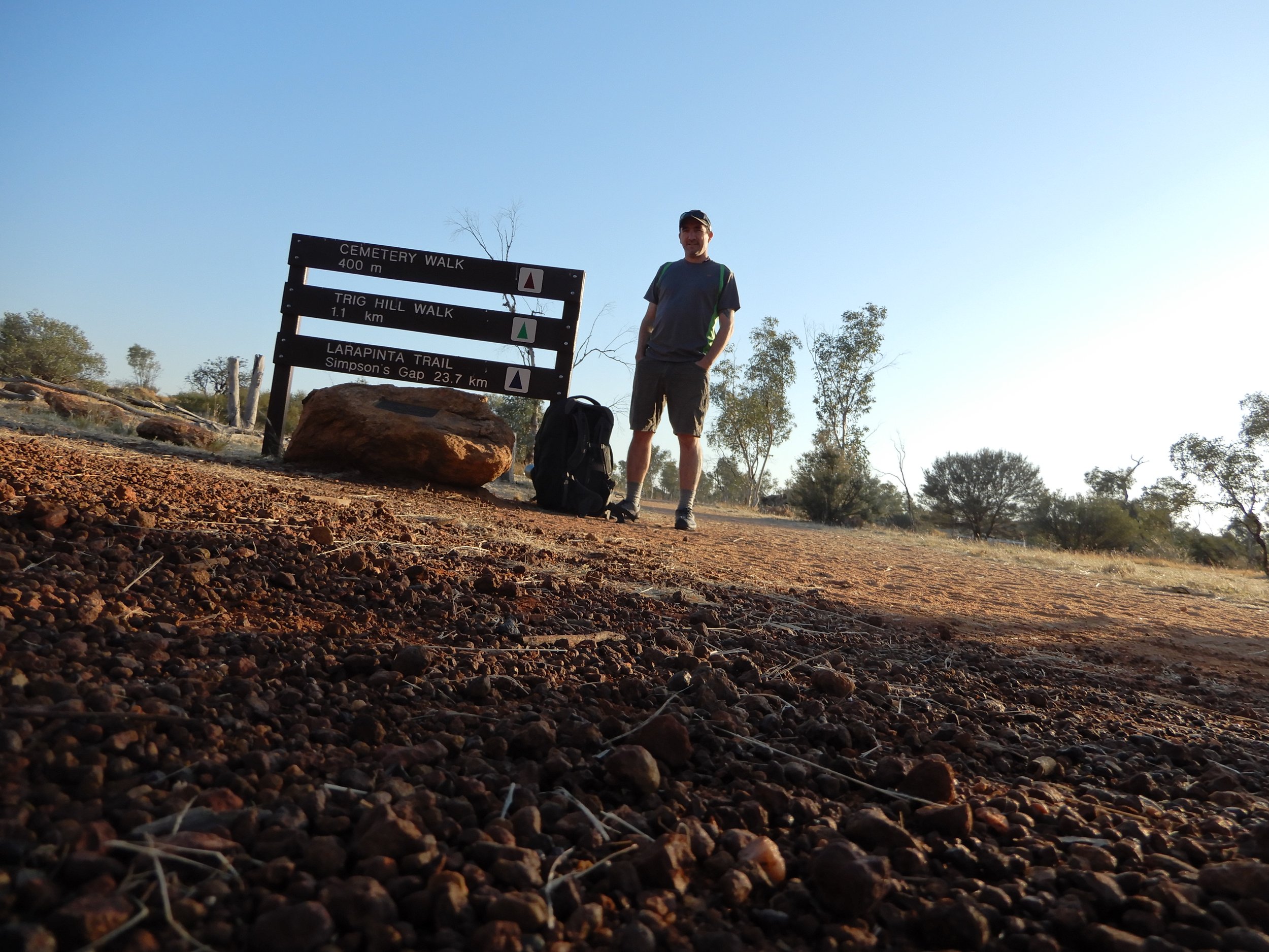
Fresh and enthusiastic, at Telegraph station, day 1
Now, this feels like the ideal place for an inspirational quote, an aphorism from a famous mountaineer or philosopher. Perhaps something from Emerson, or Hilary, or Muir, about pushing harder, overcoming, striving, looking deep within your soul, becoming one with nature. The truth is, that the following morning trepidation is the overwhelming emotion. I feel ill eating breakfast and can barely finish it. Section 4 is rated difficult, runs to 18kms, and includes 400 metres of elevation. Can I do this? Well, I don’t know, but I have to try. My pack is heavier, loaded with extra water weight due to my doubts about finishing the section. At 6:00am I head out alone into the rocky gorge, before any hint of the morning sun is visible.
Three and a half hours later I am standing atop Brinkley Bluff, one of the highest points on the trail. The views are endless in every direction, curvaceous, smoothed hills adorn the land, and a gentle breeze brushes against my face. According to the map, it should have taken 5 hours to reach this point. YES! I did it. I’m back! My hiking mojo has returned. I clench my first in satisfaction, and those nagging doubts feel like an ancient memory, carried aloft in the winds, never to be seen nor felt again.

Feeling good, atop Brinkley Bluff, day 4
Udepata (Ellery Creek, section 6) marks the halfway point of Larapinta and is on the dreaming trails of honey ants and fish. The site has hosted Arrernte people for generations, and the colossal cliffs that shade the permanent waterhole, have been carved by rain and floods over thousands of years. In the shaded northern end of the waterhole, the water is frigid, and receives little sunlight. My muscles seize from the shock, and I emerge short of breath before scampering across the pebble shore towards the fading sunlight. Although, after a 30km day the waterhole is revitalising, and I return for a second and then third plunge.
In the evening, a cloudless night sky sparkles with sequinned stars. Underneath the glittering display, the constellations of the ancient world can still be traced. The emu is the most famous image, with its head beginning near the Southern Cross, and its neck and body made up of the Milky Way. With the changing of seasons, the emu shifts position, indicating the best times for collecting eggs. Meanwhile, the Southern Cross is known as Waluwara by the Arrernte people, meaning eagle’s foot, with the four main stars representing a talon. Finally, the constellation of Pleiades, or the Seven Sisters, is a common dreaming story, and remarkably, variations are found all over the world, from oral indigenous traditions to ancient Greek fables.
The Inarlanga Pass, the first checkpoint on section 9 of the trail, is named for an elusive nocturnal echidna. It is still dark when I arrive at the pass and enter the valley towards Ltharrkelipeke (Mt Giles), and the echidnas live up to their elusive reputation. The valley runs parallel with a sacred men’s area, and the terrain conveys subtle changes, with more angular rocks protruding from the ground, and hills bearing sharper peaks. At my back, the blackness of the early morning sky is yielding to a gentle palette of mauve and pale blue. The hilltops and skeletal ghost gums make for a haunting early morning silhouette. The path ahead traverses a series of saddles, through country that is soon glowing a rich orange and brown. The clouded morning sky illuminates with tinges of fuchsia, and at the end of the valley, rising towards the heavens, a rainbow emerges. It is the most perfect morning scene imaginable, and is the talk of the camps that evening, and of every hiker who passes by.

A spooky sunrise over the Heavitree Range, day 9

Walking through the Heavitree Range, day 9
A sunrise hike to the summit of Rutjupma completes the final leg of the Larapinta Trail, and after a clumsy and difficult beginning, I have succeeded in completing the 12 sections in as many days. However, a significant amount of bandaging is required to protect my blistered feet on the final ascent. Rutjupma is also a return to women’s country, and the name means ‘pregnant lady’ in Arrernte. The climb to the summit is made significantly easier without a heavy backpack, and after waking at 4:00am, I reach the summit at 6:30am. The first light of the day is a fleeting glow of deep red crimson, before easing to gentler orange and lemon hues. Finding shelter behind a bush, from the frosty tentacles of the wind, I bathe momentarily in the silence and solitude, before a group of day hikers arrive.

Alone in the superunknown, atop Rutjupma, day 12

Sunrise on Rutjupma, day 12
Those final few kilometres, that last mile, is no longer an elusive end, and is tinged with sadness and satisfaction. Skipping down the path towards Rwetyepme I am greeted by an overenthusiastic school teacher. In his wake, a column of sullen schoolboys trudge wearily, all being cajoled towards the summit. Their surly expressions remind me of how far I have travelled, from that depressing afternoon at Angkerle Atwatye, when Larapinta felt overwhelming, and reaching Rutjupma an impossibility. And now, while my soles do ache, and my calf is swollen, and my knees are creaking like rusty hinges, my mind is refreshed, my soul alive, and there is only one thing left to do.